This is a blog dedicated to a personal interpretation of political news of the day. I attempt to be as knowledgeable as possible before commenting and committing my thoughts to a day's communication.
"Climate change is greatly increasing the flammability of the fuel available for wildfires because the trees, fallen trees and underbrush are all so dry."
"This means that a single spark, regardless of its source, can rapidly turn into a blazing inferno."
Natural Resources Canada
"What we're getting now is bigger fires, faster-moving fires and also a faster return rate of those fires."
"Instead of burning through once every 50 to 200 years, they're coming through every five years, every 10 years."
John Vaillant, author, Fire Weather: A True Story from a Hotter World
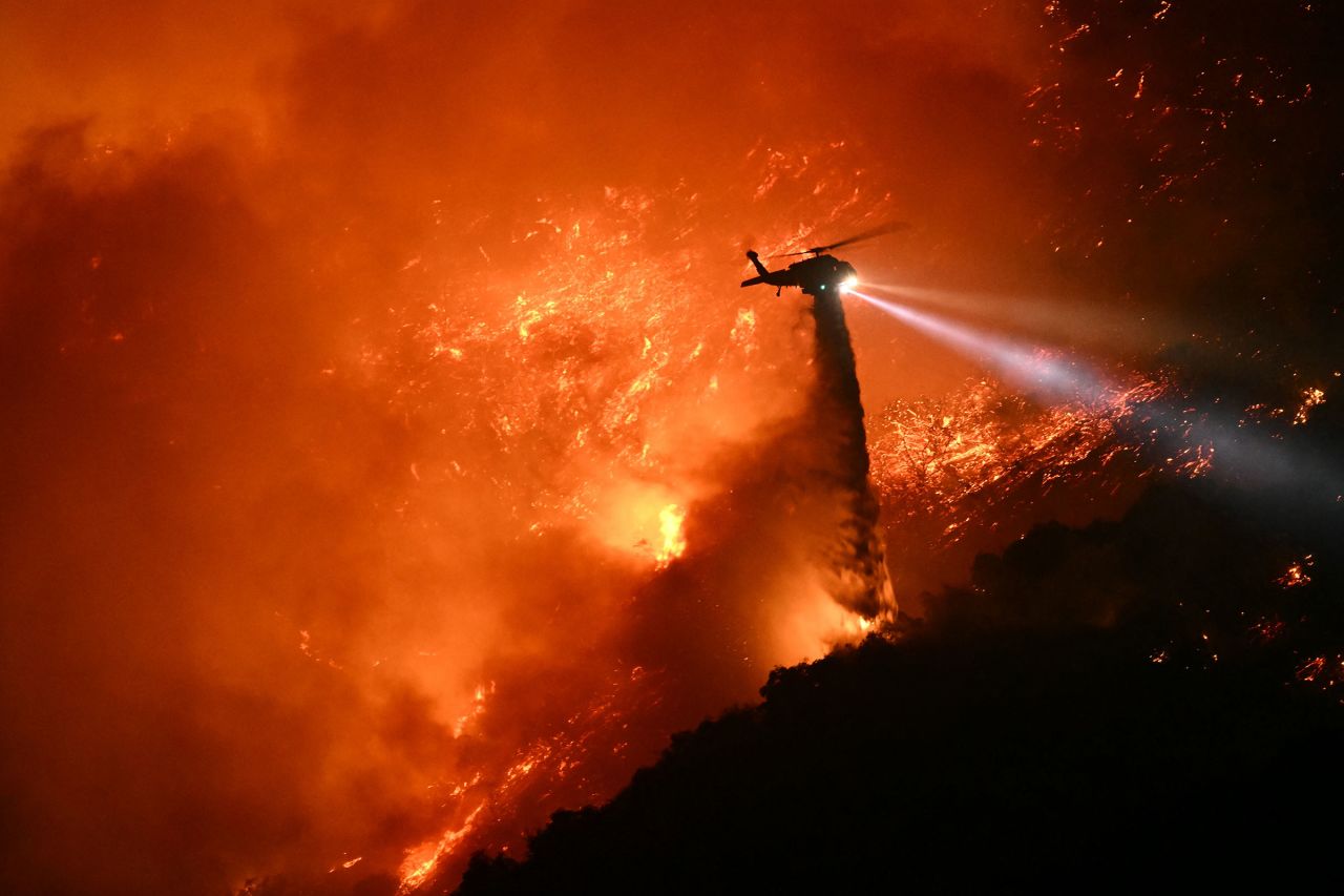
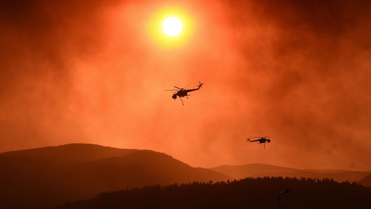
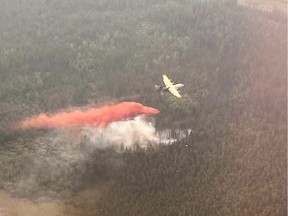
A helicopter battles wildfires near Coombs, B.C., on Sunday, Aug. 3, 2025. THE CANADIAN PRESS/Chad Hipolito
This week alone in Canada, 7.4 million hectares of forest has burned; twice as much damage as wildfires caused to date this year in the United States; almost as much as burned areas of Argentina, Chile and Columbia in combination. Saskatchewan and Manitoba declared states of emergency; a few other provinces ordered residents out, even entire communities in view of the fast-moving fires and dangerous smoke. Air-quality alerts have been triggered in the largest of Canadian cities.
In this country of massive, magnificent forests, firefighting resources are stretched to breaking across Canada. The Canadian Interagency Forest Fire Centre - the country's national firefighting co-ordinating body -- reported 721 fires raging across the country; 158 of that total are classified as out of control. The CIFFC states that national wildfire preparedness level is at the highest possible rating -- Level Five; translating to all national firefighting resources having been deployed.
In Atlantic Canada, the Weather Network states the region could expect thundershowers shortly; the other option is for the hot, dry weather to continue, fanning wildfires. Saskatchewan has lost 2.8 million hectares to wildfires this year, far more than the 1.9 million during the 2023 season which was Canada's worst year for wildfire devastation. In neighbouring Manitoba, 1.7 million hectares have been scorched; the second hardest-hit province.
Wildfire devastation has spread throughout the country with the exception of Prince Edward Island. British Columbia, Alberta and Ontario are experiencing above normal fire numbers with more forest than usual being consumed. Newfoundland's wildfires threatened St. John's and in New Brunswick 15 active wildfires were announced, two out of control. Nova Scotia is battling a new wildfire. A bolt of lightning, a discarded cigarette, a spark from a piece of machinery, all represent a source of ignition; with the right conditions the initial flame erupts and rapidly spreads.
Hotter temperatures trigger more lightning strikes. According to Natural Resources Canada, those lightning strikes cause about fifty percent of all fires, yet account for about 85 percent of annual area burned. Fires on average burn 2.1 million hectares of forest annually in Canada, according to government statistics; a fraction of the 15 million acres consumed by the 2023 inferno, barely a quarter of the loss this year to date.
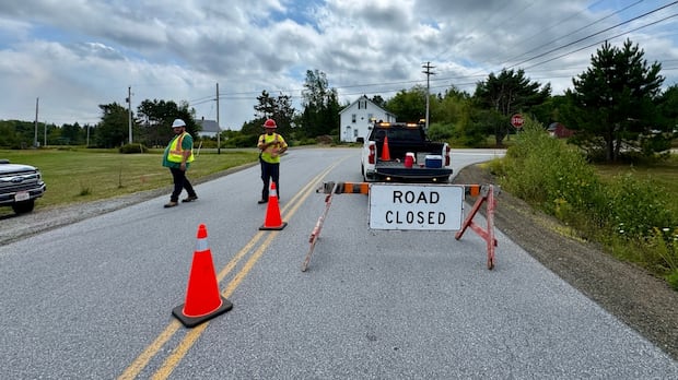
An
out-of-control wildfire in the Annapolis County community was estimated
to be 300 hectares in size on Thursday, prompting a mandatory
evacuation. CBC
Saskatchewan's Public Safety Agency states that about 80 percent of the 2025 fires in the province were caused by human activity, mostly accidental in nature, and that statistic holds for Manitoba as well. In heavily forested British Columbia, however, six of ten wildfires this year were attributed to lightning strikes. Whereas an open fire left unattended by someone began the wildfire at Susie Lake on the outskirts of Halifax, this week.
Eight firefighters died in their battle with the 2023 blazes. During the 2013-2018 period, records show that wildfire smoke contributed to some 240 premature deaths per year in Canada. A growing body of research found links between exposure to particulates from wildfires and the likelihood of being diagnosed with dementia and experiencing worsening symptoms of epilepsy and cognitive decline.
At the present time, wildfire response is a provincial and territorial responsibility. The country's fire chiefs for the past decade have been calling for a body to coordinate, support and strengthen wildfire responses across Canada. "Work is already underway to identify and advance options to improve Canada's wildfire response capacity, including better co-ordination across jurisdictions and building long-term resilience", announced Emergency Management and Community Resilience Minister Eleanor Olszewski.
Traffic is diverted as the Trans Canada Highway remains closed outside
of St. John's N.L. due to a wildfire in the Paddy's Pond area on
Wednesday, August 13, 2025. File photo by The Canadian Press/Paul Daly
There is no Consolation for Devastation Wildfires Produce
"[The Los Angeles area] had another night of unimaginable terror and heartbreak, and even more Angelenos evacuated due to the northeast expansion of the Palisades Fire."
County supervisor, Lindsey Horvath
"We're not out of the woods yet. We have some very significant fire
weather ahead of us."
"We've prepositioned additional engines, fire crews, helicopters,
bulldozers, water tenders across all of Southern California ... all
poised to assist and support the additional fire threat."
Nancy Ward, director of the California Office of
Emergency Services
"There's likely to be a
lot more [fatalities in the wildfires devastating the Los Angeles area]."
"We
always have to be careful on the death toll."
"I've got search
and rescue teams, we've got cadaver dogs out, and there's likely to be a
lot more."
California Governor Gavin Newsom
"To all residents, please be assured that we will continue to be here
for you until the last fire is completely extinguished."
"We stand alongside all of you as we begin to plan for the repopulation
of evacuated areas, establishment of disaster recovery centers, and the
rebuilding of your homes, your communities, and your lives."
Los Angeles County Fire Chief Anthony Marrone
"[Curfews remain in place for the Pacific Palisades
and Brentwood neighborhoods, which is a] measure that is necessary to
ensure public safety, as high winds are expected to pick up again."
"[The
Palisades Fire] remains active, and as others have said, this situation
is far from over."
"Pacific Palisades still faces dangerous
conditions, including downed power lines, broken gas and water pipes and
now slide conditions because of water activity."
Los Angeles City Council member Traci Park
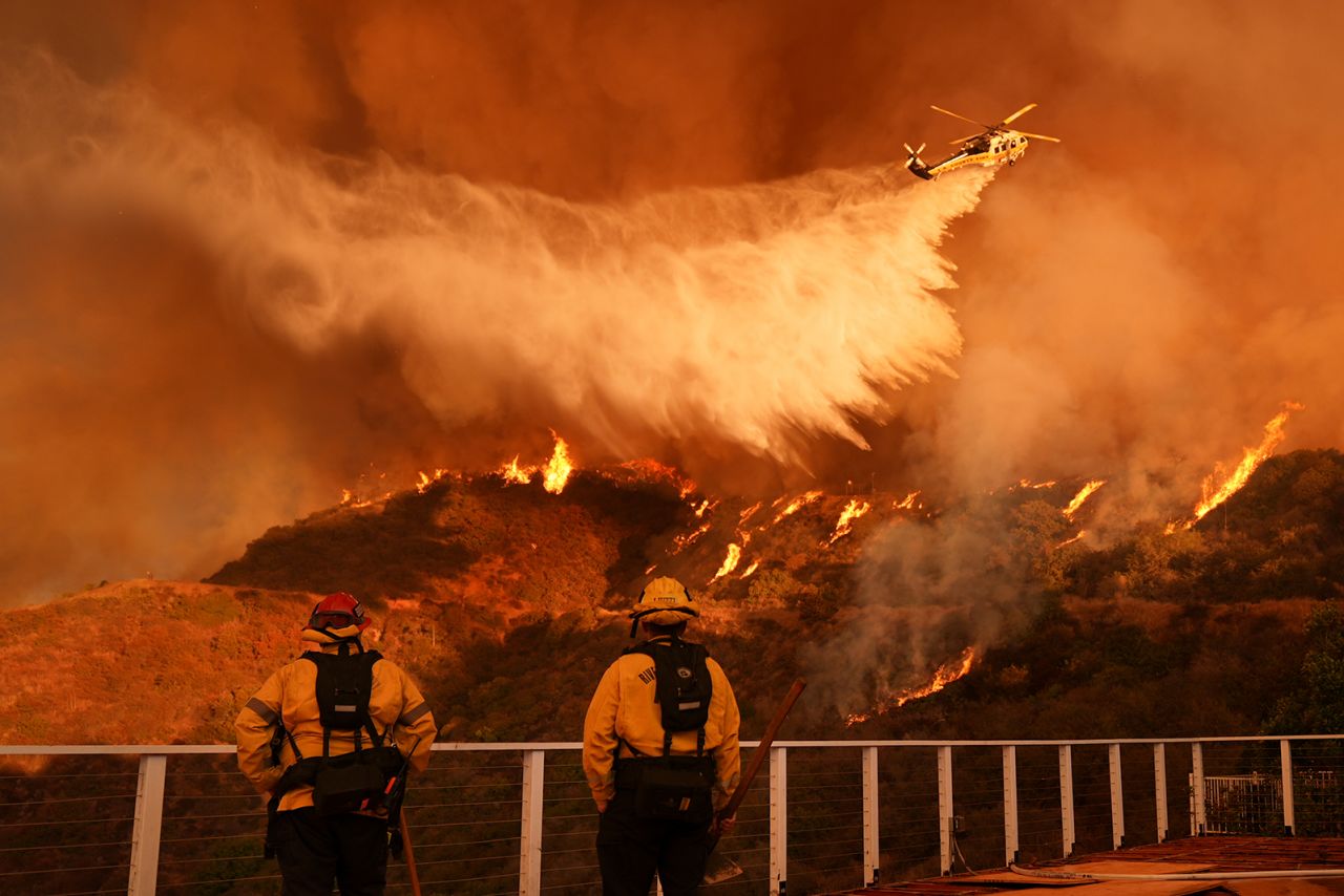
Firefighters watch as water is dropped on the Palisades Fire in Mandeville Canyon, in Los Angeles, on January 11.Jae C. Hong/AP
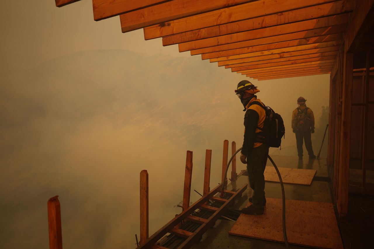
Spreading wildfires saw firefighters racing to cut them off before the return of howling winds that could shove the flames closer to the J. Paul Getty Museum and the University of California Los Angeles. More home-owners were left on edge by new evacuation warnings, as a fierce battle was underway in Mandeville Canyon against the flames. Swooping helicopters were seen near the Pacific coast, dumping water on the downhill charging blaze. On the ground, firefighters were using hoses in an effort to beat back flames leaping everywhere, as thick smoke blanketed the hillsides.
CalFire operations chief Christian Litz explained their major focus on the Palisades Fire in the canyon area, not far from the UCLA campus. "We need to be aggressive out there", he said. The National Weather Service warned strong Santa Ana winds could soon return to replace the light breezes that were fanning the flames on Saturday. Santa Ana winds have been credited for the infernos that the wildfires were transformed into, levelling entire neighbourhoods which have seen no rainfall of any significant for the past eight months.
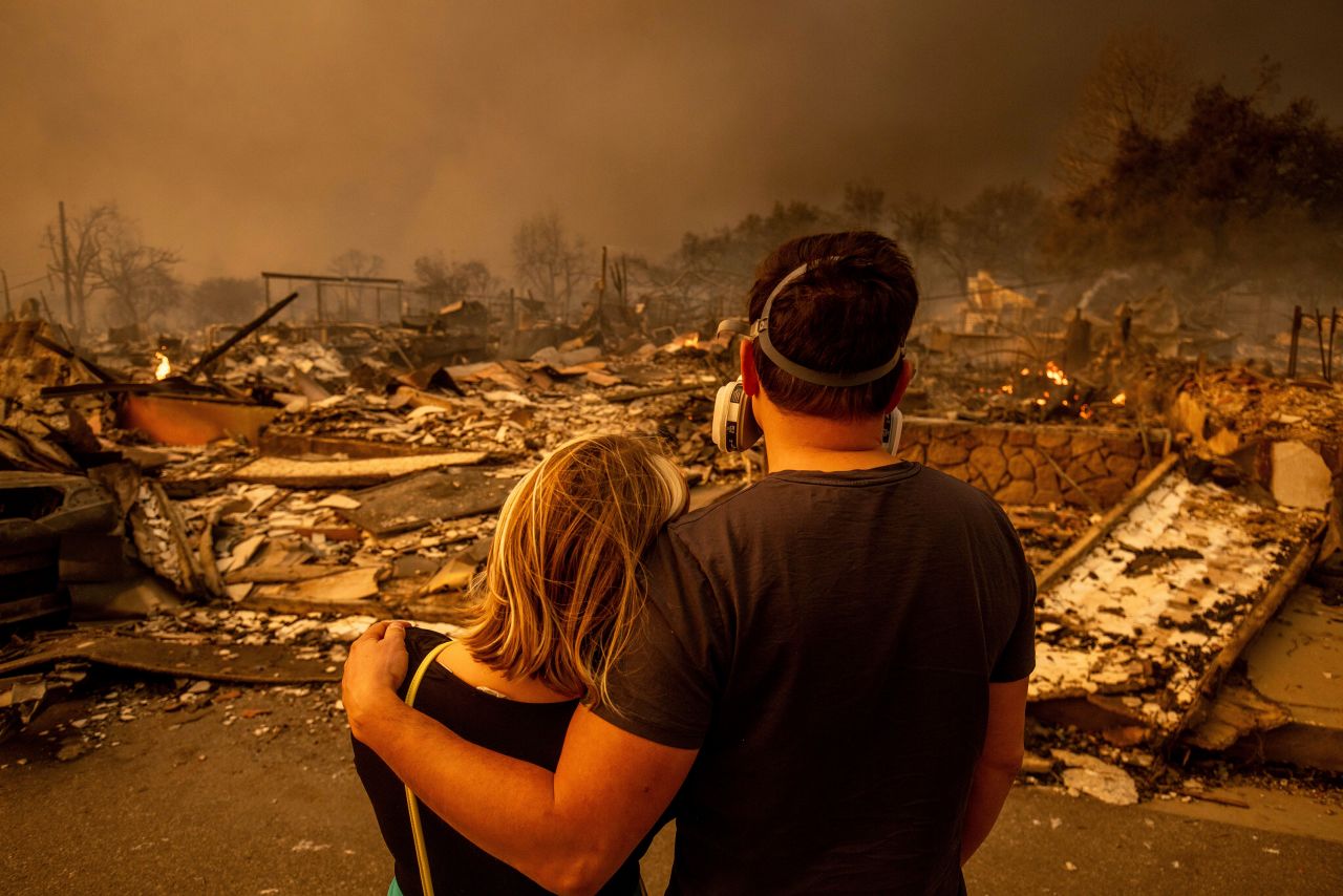
Megan
Mantia, left, and her boyfriend Thomas, return to Mantia's fire-damaged
home after the Eaton Fire swept through in Altadena, California, on
January 8. Ethan Swope/AP
There were fears that the fire threatened to leap over Interstate 405, into the Hollywood Hills and San Fernando Valley, both highly populated. Teams conducted systematic grid searches on Saturday in the grim work sifting through the devastation with cadaver dogs. A family assistance centre was set up in Pasadena as Los Angeles County Sheriff Robert Luna urged residents to abide by curfews. "We have people driving up and around trying to get in just to look. Stay away."
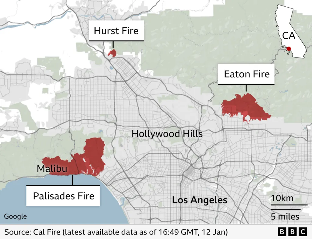
The death count now stands at 26. Over 12,000 structures have been burnt to a cinder. Some 145 square miles have been consumed by the fires. Tens of thousands remain under evacuation orders while new evacuations were ordered Friday evening, following a flare-up on the Palisades Fire eastern side.Since the start of the fires on Tuesday north of downtown Los Angeles, structures including homes, apartment buildings, businesses, outbuildings and vehicles have been burned.
No cause has yet been attributed to the largest fires that have caused the nation's costliest wildfires event in its recorded history. Donation centres on Saturday were overwhelmed by volunteers to the point that many were turned away, although donations of necessities were accepted. Some residents have been returning in hopes of salvaging keepsakes, sifting through what was left of their homes in the rubble.
People were urged by officials to stay away. The ash, they warned, can contain lead, arsenic, asbestos and other dangerous materials. "If you're kicking that stuff up, you're breathing it in", advised a spokesman for the unified command at the Palisades Fire. "All of that stuff is toxic."
"We're
looking for a little respite on Friday and Saturday from the Santa Ana
winds but then they're going to pick up again Sunday through most of
next week."
Meteorologist Rich Thompson
"[Right now, it's impossible to quantify the extent of the destruction other than] total devastation and loss."
"There are areas where everything is gone, there isn't even a stick of wood left, it's just dirt."
Barbara Bruderlin, head, Malibu Pacific Palisades Chamber of Commerce
"I've lived out here since the mid-80s and I don't think I've
experienced anything as strong and forceful as these winds. I'm looking
at a number of houses that have been destroyed of people I know."
"Not
everybody who lives in California is a multimillionaire. There are a
lot of [regular] folks here. If you're a person who doesn't have good
finances, this is going to be devastating."
"I think this is a game changer for Los Angeles. People
are going to have to re-evaluate where they live and I'll be surprised
if they're going to rebuild in the areas quickly."
Hollywood Actor John Kapelos
A still from a video that Kapelos took from his condo's rooftop on
Tuesday near La Brea and Franklin Avenues, looking west from Hollywood
toward the Pacific Ocean. (Submitted by John Kapelos)
"It's been scary. Looking around, you can see the smoke in
the air and you're smelling it. Obviously the air quality is terrible
right now."
"All these areas that are on fire, the majority of them are in the
hills, so those are really narrow and winding roads, and a lot of people
park on those streets and are trying to get out, so getting a firetruck
up there would be an absolute nightmare. That really slows things
down."
"I've had a few people I know who've lost their homes. Right now,
they're just in shock because there's places they've been in for decades
and all of a sudden everything is gone. Basically they just have what
they could fit in their cars and nobody knows the next steps."
David Cooke, realtor, Toluca Lake neighbourhood
A man walks in front of the burning Altadena Community Church on
Wednesday in in Pasadena, Calif., as wildfires continued to create
devastation in the L.A. area. (Chris Pizzello/The Associated Press)
To
the present, 16 people have died in the blazes in the Los Angeles area.
Entire neighbourhoods have been obliterated in America's second-largest
city. Firefighters had hoped for a break frmo fierce winds that
fuelled the area's massive blazes. Over 10,000 homes have been burned,
along with other structures since Tuesday. Fires first began appearing
around the 40-kilometre expanse north of downtown Los Angeles, a densely
populated area.
Firefighters monitor the advance of the Palisades Fire in Mandeville Canyon on January 11.
Eric Thayer/AP
California
is accustomed to massive wildfires. Even so the shock at the fierceness
and swift spread of these fires are like none before them, with dozens
of blocks of Pacific Palisades flattened, and smouldering -- rubble only
remains. The 13 million inhabitants of Metropolitan Los Angeles awoke
Friday to another day of high winds stoking the fires with the threat of
new flare-ups. Earlier in the week hurricane-force winds ignited the
nearby hillsides with embers.
The
forecast by meteorologist Rich Thompson was for Santa Ana winds to pick
up once more on Sunday and throughout the following week. Thursday
afternoon, the San Fernando Valley Kenneth Fire saw new blazes where
evacuees from another fire were taking shelter in a school. An
aggressive response by firefighters managed to quell the flames in
neighbouring Ventura County. Calmer winds and out-of-state crews helped
firefighters beat back two devastating wildfires.
Over
5,000 structures were burned in the Altadena area by the Eaton Fire.
Finally, firefighters have seen progress in containing the Eaton blaze.
The fire in Pacific Palisades, the largest in the Los Angeles area,
destroyed over 5,300 structures, with firefighters establishing the
first containment on Thursday. Even so, that blaze is considered the be
the most destructive in the history of blazes in Los Angeles.
With
the assistance of aircraft water drops, crews were able to knock down a
blaze in the Hollywood Hills. The famed Hollywood Bowl outdoor concert
venue was close to immolation near the heart of the entertainment
industry. No figures have yet been released on the cost of the damage
to date, but AccuWeather on Thursday increased its preliminary estimate
of the damage and economic fallout to a range of $135 billion to $150
billion.
A fire fighting helicopter drops water on the Palisades fire on January 11.
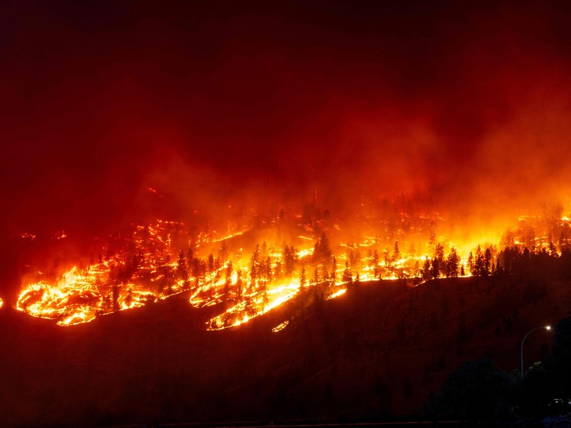
The McDougall Creek wildfire burns in the hills in West Kelowna on Aug. 17, 2023, as seen from Kelowna.Photo by DARREN HULL /AFP via Getty Images
"Then the flames started, and they started everywhere all at the same time because it was an ember shower."
"We're a pretty small fire department, we have three apparatus, so we tried to do our best but there was just absolutely no way that we could attack all of it. And as soon as you don't attack it, it spreads."
"We fought for as many houses as we could. We stopped the flame front and saved probably, I'd say, 65 to 75 percent of the houses in Traders Cove."
"I saw my house burn. When we were fighting the fires in Traders Cove, we literally had fire personnel with their backs to their house that was burning behind them, and they were fighting the neighbour's, trying to save the neighbourhood."
"It was extremely, extremely fast. The wind was blowing directly, I mean literally, at my house. It was a wall of fire 100, 125 feet high, travelling 35 kilometres an hour."
"It was surreal. It was watching nature at its worst. ... It just kind of ate my house."
Paul Zydowicz, chief, volunteer fire department, Wilson's Landing, British Columbia
"I quickly found myself in a pretty tricky battle. I was able to call in our own firefighters to come and help me. And that's when it became real for me that we were surrounded by fire and it was bearing down on our community hard. And we were all in the fight of our careers."
"I was thinking: If we just had one more fire engine we could save that house. And if we had one more fire engine, then we can save those other two houses. And if we had one more, we could get the other ones on the other side of the street. And, you know, of course you can never have enough resources in that situation."
"It's unprecedented. We are not used to fighting wildfire fire against six-storey condominium buildings."
Jason Brolund, West Kelowna, McDougall Creek wildfire
"It moved 20 km south in under 12 hours, which is extremely [aggressive] for fire behaviour in British Columbia."
"That is a force of nature similar to a tornado, similar to an earthquake or a tsunami."
Forest Tower, B.C. Wildfire Service Information officer
"[The fire that blew into this region] was something I've never seen before."
"When I saw the flames coming that day, it was something bigger than any of us could handle."
"but the community rallied together, they saved what they could save. It was actually just among the most impressive displays of community spirit I've ever seen."
"I want to stress the fact that we've lost structures, people are hurting, but we haven't lost lives -- not yet."
District deputy regional fire chief Sean Coubrough
"This MacDougall fire has been a very harrowing experience for everyone. I'm grateful that there has been no confirmed loss of life that we know of, and we hope that this remains."
"It's very devastating for the loss of property and the impact of businesses that has occurred. There's lots of collective grief and high emotions."
Chief Robert Louie, Westbank First Nation
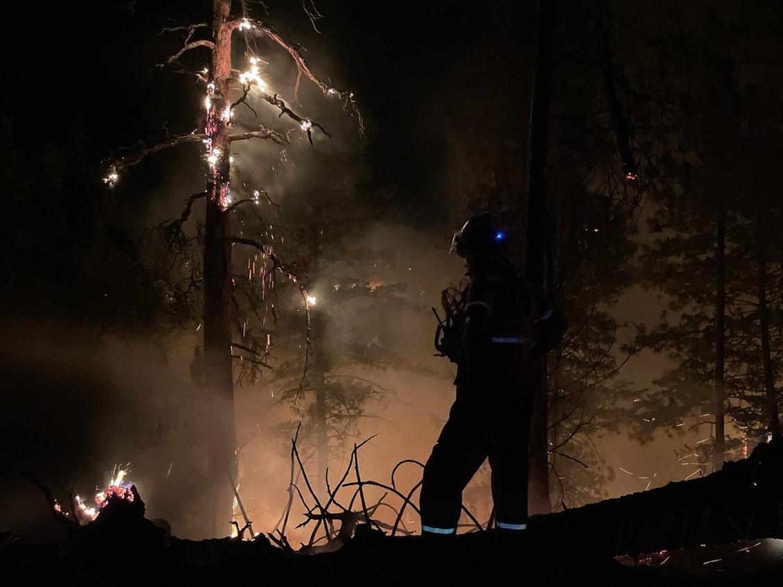
Photo from the frontlines as Wilson's Landing firefighters battled the McDougall Creek blaze north of Kelowna.Photo by Wilson's Landing Fire Department
As gusting winds whipped up the McDougall Creek wildfire, airplanes dumped fire retardant in the area. Fire chief Zydowlicz had firefighters staked out on the west side of Okanagan Lake, additional crews on a local forest road. As evening fell flames could be seen thrusting toward Wilson's Landing. The two dozen on-call firefighters with three trucks stared down the fast-moving blaze, leaping and growing voraciously.
That was August 17, the start of the worst week of the worst year for wildfires in the history of British Columbia, which led to hundreds of properties damaged, thousands of evacuations across the province, and hundreds of firefighters arriving from near and abroad to pitch in and work as an emergency team to address the crisis. A day later the McDougall Creek wildfire blew into West Kelowna, roughly 13 km south.
Jason Brolund, the city's fire chief spent the day organizing how best to attack the blaze, overseeing the command post in the city. On his way home August 18 for a few hours of sleep he stopped in West Kelowna Estates to check on his firefighters and an "overwhelming" scene assailed him. A colleague pointed him to a subdivision street not yet visited by the firefighters. He knocked on doors to check that residents had evacuated, and as the night sky glowed orange fluorescence, firefighters used water from swimming pools "right before it hits the person's lawn, like inches from the house".
The inferno melted street signs, uprooted large trees, and ripped propane tanks open, blowing them into the woods. At Wilson's Landing firefighters attacked the blaze roaring north along Westside Road, work that stretched into the next morning, staying one step ahead of the flames to protect small communities, but finally forced to retreat 10 km when they reached the Lake Okanagan Resort.
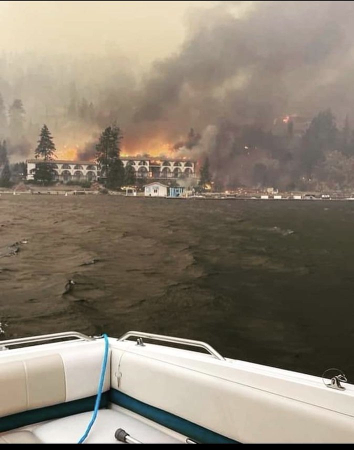
Lake Okanagan Resort on fire Photo: Tedd Buddwell
"The fire chased us out of Lake Okanagan resort" explained Chief Zydowicz. Boaters posted photographs of the 217-room historic resort engulfed fully in flames. The tradespeople, doctors, lawyers and entrepreneurs who formed the troop of volunteer firefighters experienced a harrowing 22 hours. Two were injured; one with facial burns, the other a broken wrist. "These two firefighters, after being treated at the hospital, called me from the hospital and said put me in a next shift please, and preferably earlier", said Chief Zydowicz.
Along with losing his own house, the fire had destroyed $150,000 in boats and other gear for his riverboat company, Northwest River Boats. Other Wilson's Landing firefighters lost everything and continued to fight the wildfire. The fire in the North Westside rural area destroyed or damaged about 90 properties in both Traders Cove and Wilson's Landing, as well as a children's summer camp. Most homeowners had heeded evacuation orders, even though a handful were rescued after waiting too long to leave.
In the city of West Kelowna and the Westbank First Nation another 84 properties were damaged or destroyed, along with four in Kelowna and three in Lake country. West Kelowna firefighters that afternoon fought a ground fire that was threatening a gas storage facility, a mobile home park and a number of new condominium developments. That day in mid-August was hot, dry and windy across most of the province. Other areas of the province saw mounting fire crises with several communities in the Columbia Shuswap Regional District given evacuation orders as the area faced "its most devastating wildfire day in history".
A base camp for 400 firefighters west of Adams Lake was forced to evacuate when the fire risk was acute and cold air whipped up the nearby Bush Creek East fire. Under 12 km from the camp the Lower East Adams Lake fire was increasing in intensity close to the Interfor Adams Lake Mill, a major area employer. It was saved, while flames tore south attacking other communities on the north side of Shuswap Lake. Losses of 100 homes were reported by residents in Scotch Creek and Celista.
By August 20 the situation began to change when Chief Broland said "We're now four days in. It feels like months. But things are looking better. We are finally feeling like we're moving forward rather than we're moving backwards, and that's a great feeling for all of us to have. In saying that, make no mistake, there will be difficult days ahead, and we are continuing to prepare and address those."
A recent photo of some of the Wilson’s Landing
firefighters. Thirteen people in the 24-member department lost their
homes in the blaze. Photo: GoFundMejpg
"Given that there have been no reports of a missing person or missing residents from the surrounding areas, the possibility is being investigated that these are people who had entered the country illegally."
Ioannis Artopios, spokesman, fire department, Avanta area
"When we add the fires in Canada, the United States, Africa, Asia and
Australia to those in Europe, it seems that the situation is getting
worse every year."
Antonello Fiore, president, Italian Society of Environmental Geology
Helicopters fly over as wildfire rages near Alexandroupolis, northern Greece, on August 21, 2023. Sakis Mitrolidis/AFP/Getty Images
The bodies of 18 people were discovered by firefighters scouring the area of a major wildfire in northeastern Greece, burning out of control Tuesday for a fourth day. Authorities were left to consider whether the group remains might be those of migrants who had entered Greece through its nearby border with Turkey.
Hundreds of firefighters were battling dozens of wildfires breaking out across the country, with galeforce winds fanning the flames. Two people died on Monday while two firefighters were injured in separate fires in northern and central Greece. The 18 bodies were found in the Avanta area of the city of Alexandroupolis.
The hot, dry summers of southern Europe are especially susceptible to wildfires. Across Tenerife in Spain's Canary Islands, another major blaze has been burning for a week, with no injuries or home damage yet reported. Blame is being placed by European Union officials squarely on climate change to explain the increasing frequency and intensity of European wildfires.
Police activated Greece's Disaster Victim Identification Team in hopes of identifying the 18 bodies discovered close to a shack in the Avanta area. Alexandroupolis sits close to Greece's border with Turkey, along a route frequently used by people fleeing poverty and conflict in the Middle East, Asia and Africa, seeking to enter the European Union.
Many villages and settlements close by Avanta were under evacuation orders, push alerts sent to mobile phones. A massive wall of flames raced overnight through forests toward Alexandroupolis that prompted authorities to evacuation an additional eight villages along with the city's hospital. The sky over the city was flaming red and choking smoke with swirling ash flecks filled the atmosphere.
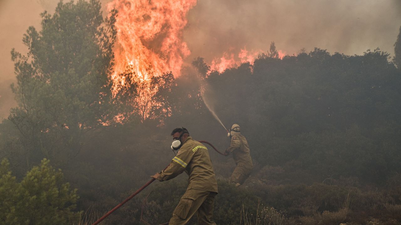
Firefighters battle flames during a wildfire near Prodromos on August 21, 2023.Spyros Bakalis/AFP/Getty Images
The city's hospital transported 65 of its over 100 patients to a ferry boat docked at the city's port; mores were taken to other hospitals in northern Greece. Another 20 patients were ferried to the port town of Kavala, to be transferred from there to yet another hospital. Speaking on Greece's Skal television the country's deputy health minister explained that the Alexandroupolis hospital moved its patients elsewhere given the smoke and ash circulating, as a threat to health toward already compromised people.
Patrol boats and private vessels evacuated another 40 people by sea from areas west of Alexandroupolis, ferrying them to the port. Satellite imagery showed smoke from a fire burning through forest in a protected national park, blanketing northern and western Greece. Woodland northwest of Athens and at an industrial area on the capital's western fringes were susceptible to new fires that broke through in parts of the country.
From the industrial area of Aspropyrgos, small explosions resounded as flames reached warehouses and factories, authorities shutting down a highway and ordering the evacuation of nearby villages. Greece, with its firefighting forces stretched to the limit, appealed for help from the civil protection mechanism of the European Union.
The response was five firefighting planes from Croatia, Germany and Sweden, and a helicopter, 58 firefighters and nine water tanks from the Czech Republic heading to Greece on Tuesday. Two aircraft from Cyprus arrived on Monday as did 56 Romanian firefighters. A blaze on the island of Evia was being tackled with the assistance of French firefighters. "We are mobilizing actually almost one third of the aircraft we have in the rescEU fleet", EU spokesman Balazs Ujvari recounted.
Flames burn a forest during a wildfire on Parnitha mountain near Hasia suburb, northwestern Athens, 22 August 2023. AP Photo/Thanassis Stavrakis
"Grocery stores aren't open. There's no services here in town. The smoke's going to get thick, so really encouraging folks [to] head out now."
"Please don't spread rumours. There's no looting in Yellowknife."
"RCMP are patrolling the neighbourhoods. I contacted them this morning. I saw them on my walk to work this morning."
"There is no looting. Your homes are safe. You've gotta lock up and head out of town."
Yellowknife mayor Rebecca Alty
Rebecca Alty,
Yellowknife's mayor, says there are still exit options for people who
stayed behind in the N.W.T. capital. 'The fire is approaching, we're
working hard to stop it but let's not get to a situation where we have
to do that emergency evacuation,' CBC News
"It's a ghost town. This is kind of the D-Day for the fire effort. If it's going to get bad, it's going to get bad today."
"It's kind of like having a pint at the end of the world [exhausted firefighters taking a break at one bar still open, following long shifts]."
"Our members [First Nations] know the land better than anyone else. We're confident they'll be safe out there [those residents who choose shelter in cabins or camps out on the land]."
Kieron Testart, Yellowknife
Fishers Stephanie Vaillancourt and Annika Olesen, seen here on
Friday, have a plan to shelter in place as wildfires threaten
Yellowknife. (Jennifer Gauthier/Reuters)
Yellowknife has become a ghost town, as wildfires loomed nearby while the territorial capital's mayor urged residents to put away their fears of looting, and leave while they still could. The city of 20,000 saw thousands leaving by air or road Friday while a noon deadline to leave approached. Its goal was to see that everyone could evacuate in an orderly manner before the fire at 15 kilometres distance from the outskirts of the city, advanced to cut off access.
1,600 people will remain in the city, workers fighting the flames, hoping to save as much of the city as possible. 236 fires are burning in the territory, a wildfire situation that is critical.
According to officials, the roads would remain open while flights would continue past the deadline as long as both avenues remained safe. Once-busy streets in the city had emptied, stores and businesses shuttered. Yellowknife gas stations were still operating, those that still had fuel. A single grocery store and a pharmacy remained open for the time being. Some First Nations people have chosen to take shelter in place while most people were clearing out.
"Busy skies today", commented fire information officer Mike Westwick, as work battling the flames continued. Eleven air tankers flew overhead, another plane dropping fire retardant, while a ten-kilometre fire line had been dug, backed up by 20 kilometres of hose and a plethora of pumps. Fire fighting implements representing "the most extensive heavy water operation we've ever seen in the territory", commented Westwick.
People
who were evacuated from Yellowknife due to an approaching wildfire are
watching from places like Alberta to see what happens with the ongoing
fires in the Northwest Territories. CBC
Havoc was threatening, with winds picking up from the north and northeast being predicted for Friday and Saturday. Hoped-for rain failed to materialize overnight, in an already drought-stricken environment. "Both of those winds would push the flames in directions we don't want them to go. We've still got some really difficult days ahead. There's no denying that", commented Mike Westwick.
Sprinklers, water cannons and fireguards were set up Wednesday as evacuation orders were given late on Wednesday. The following day, about 1,500 people left on evacuation flights, in addition to commercial planes. More flights scheduled for Friday that could see roughly 1,800 additional people leave the city. Steady, orderly convoys of vehicles headed for evacuation points on the main highway out.
A Thursday view of another wildfire burning to the northeast of Yellowknife near the Ingraham Trail. (N.W.T. Fire)
"I urge all residents under evacuation orders to please adhere to them as they are issued."
"These orders are never issued lightly and always consider our collective health and safety."
"You could be jeopardizing your safety and that of others."
North West Territories' environment and communities minister, Shane Thompson
"We have been in a blocked pattern across North America all week long."
"That kept an area of upper level low
pressure stuck over the Northeast. The flow around the low pressure has
been guiding wildfire smoke from Quebec into the Northeast, Great Lakes,
and even Ohio Valley and down in the mid-Atlantic."
Jen Carfango, Weather Channel meteorologist
Wildfire near EdsonPhoto Gov Alberta Fire Service
"The Air Quality Health Index (AQHI) is a scale from 1 to 10+ that provides an indicator of the health risk related to air quality and can be found on the Environment Canada website or provincial environment ministry sites. Canada’s WeatherCAN app can send alerts about what to do when the air quality is poor."
"There are growing concerns about how to grapple with the long-term health impact of worsening air quality. Experts advise higher-risk individuals to take immediate steps to protect themselves when the risk level of the AQHIincreases.
According to the index, levels of 4 to 6 are considered moderate risk
and vulnerable individuals are urged to reduce or reschedule outdoor
activities. Levels of 7 to 10 are considered high risk, and anything
above 10 is considered very high risk."
murat yükselir / THE GLOBE AND MAIL Source: Government of Canada
Image released by the Ontario
Ministry of Natural Resources and Forestry, the Sudbury 17 wildfire
burns east of Mississagi Provincial Park near Elliot Lake, Ontario, on
June 4, 2023.
Canada, beset by an earlier-than-usual wildfire season this year, has been forced to confront a much worse than usual wildfire season. Close to 350 firefighters from the European Union are arriving in Quebec alone to give aid to Canadian wildfire fighters tackling a devastating season. Over a hundred French firefighters arrived a week ago to spend the weekend putting out flames in Quebec where 14,000 people were forced to flee from their homes, threatened by fast-approaching fires.
Reinforcements from Portugal numbering 140, along with another 97 from Spain are expected in Quebec City; the first time in the European Union Emergency Response Coordination Centre's 22-year history it has sent firefighters to help in Canada. "There is this solidarity. Today unfortunately, it's Canada that is facing these terrible fires. But last year in Spain, it was also a terrible year", noted Claire Kowalewski, the EU's ERCC's liaison officer, stationed temporarily in Canada.
The destruction from this year's wildfire season has been described by Canadian officials as "unprecedented", with nearly 430 forest fires roaring through the country on Sunday, 210 of them burning out of control, according to the Canadian Interagency Forest Fire Centre. They have necessitated widespread evacuations, forcing over 100,000 people in nine provinces and territories to leave their homes for safety to escape swiftly-spreading flames.
Personnel from the Royal Canadian Air Force are helping battle the fires
on the North Shore of Quebec. (Royal Canadian Air Force)
By Wednesday, 459 wildfires raged across Canada, 234 listed as out of control. There are now 5,000 firefighting personnel from varied countries who have been deployed across Canada to help in the battle against the all-consuming flames with more expected to arrive from Chile and Costa Rica in coming days. Contingents of French and American reinforcements are helping to fight 130 fires raging across Quebec. In the province, 2,800 people remain under evacuation down from over 13,500 last week.
Some 14,000 people were unable to return to their homes in Alberta even as a large portion of Western Canada is anticipating forecasted rain, along with risk of lightning. A major highway in British Columbia, connecting Yukon and northern British Columbia to the rest of the province now is threatened by the huge Donnie Creek wildfire, the blaze chewing through woodlands south of Fort Nelson, B.C. An evacuation alert has been posted for a section of the Alaska Highway by the Peace River Regional District as flames creep within two kilometres.
The B.C. Wildfire Service has reported over 80 active wildfires province-wide, with 37 ranked out of control, in the northeast and another on Vancouver Island included. The Island fire charred over two square kilometres of trees on steep hillside above the only highway linking Port Alberni, Tofino and Ucluelet to the rest of the region. Air quality statements have been posted by Environment Canada for northeastern B.C.
Wildland firefighters work in a forest in Normétal, Que., on June 11, 2023. (Caroline Boyaud/SOPFEU hand out/The Canadian Press)
"We haven't seen anything close to the most intense heat waves possible under today's climate, let alone the ones we expect to see in the coming decades."
"Every time record temperatures or precipitation go well beyond what we've experienced during our lifetime, that's usually when we're unprepared and the damage is largest."
"We should no longer be surprised if we see records smashed by large margins."
Erich Fischer, climate scientist, ETH Zurich
"[New research shows that] we must expect extreme event records to be broken -- not just by small margins, but quite often by very large ones."
"This highlights the huge challenge to improve preparedness, build resilience and adapt society to conditions that have never previously been experienced."
Rowan Sutton, climate scientist, National Centre for Atmospheric Science, University of Reading
B.C.
Wildfire Service responded to the Brenda Creek wildfire (K51924)
burning south of the Okanagan Connector, highly visible from the
roadside.Photo by B.C. Wildfire Service /PNG
As scientists with the Intergovernmental Panel on Climate Change begin two weeks of virtual meetings for the purpose of finalizing their next global climate science assessment, a study was published Monday in the journal Nature Climate Change, that warned the next three decades would see "record-shattering" heat waves, two to seven times more frequently around the world, than what has occurred over the past three decades.
Canada, Cyprus, Cuba, Turkey, Northern Ireland, Antarcitica have all recorded their warmest-ever temperatures in the past two years. Should current greenhouse gas emissions trend continue record-breaking heat waves may be three to 21 times more frequent beyond 2050, according to the study.The researchers used climate modelling in the calculation of the likelihood of record-breaking heat lasting at least seven consecutive days, far surpassing earlier records.
Given such extremes, the study warns that communities need to be preparing for such extremes. The June heat wave that struck Canada was responsible for the deaths of hundreds of people in British Columbia, reaching 49.6C in the village of Lytton, when a heat dome straddled the sky over the area, the intense heat contributing to an explosion of wildfires, one of which completely destroyed the evacuated town.
Damaged buildings are seen in Lytton, B.C., on July 9, after a wildfire destroyed most of the village on June 30. (Darryl Dyck/The Canadian Press)
The study suggests that should greenhouse gas emissions be cut aggressively the likelihood of heat waves while remaining high, would result in diminishing opportunities of exceeding heat records over time.
"It was probably the single largest pyrocumulonimbus storm of the year so far. In fact, we're still tracking the smoke plume from that storm as it's travelling around the world and it's about to kind of come full circle back over [the] U.S.A. and Canada."
"When you get all those three things together [fuel, heat and wind], you get the perfect triple that we call fire weather. So, hot, dry and windy."
"It’s just like if you have a stove and you have a small burner —
you’re not going to get as much of a fast boil in your pot as if you had
a really hot, intense burner."
"So, the big, large
fire just makes it that much easier for the air to be completely upset.
And then if you do form a cloud, then that generates even more buoyancy
and that feeds back down to the fire."
Michael Fromm, meteorologist, U.S. Naval Research Laboratory
"The fire creates the storm and then the storm creates lightning, which can cause more fires."
"That runaway feedback is the dangerous part."
Simon Donner, climate scientist, University of British Columbia
"It's been an exceptional year."
"Most of them [Canadian Forces firefighting teams] are actually camping along the fire lines overnight."
"During the day, they walk the fire line and check for any areas where there's flare-ups or hot spots and they suppress those."
Lt.-Col. Jesse van Eijk
A pyrocumulonimbus cloud generated by the Clear Range bushfire to the south of Canberra, Australia, February 1, 2020, Brook Mitchell/Getty
Wildfires in Canada generated through a combination of intense heat and drought conditions are so extreme they generate their own weather systems. The phenomenon is known as a pyrocumulonimbus firestorm, tracked this year as they occur in British Columbia, Saskatchewan, Alberta, Manitoba and Ontario. The first one tracked in May occurred in Manitoba. B.C.'s Lytton brewed up firestorms on two successive days in late June, hitting a Canadian temperature high of 49.6C a day prior to a wildfire erupting.
Emergency Management BC announced the presence of over 250 active wildfires charring B.C. forests where 4,142 square kilometres of land has burned since April 1 from 1,215 wildfires. The situation so dire that Canadian Forces were deployed to British Columbia and Manitoba to fight the fires, assisting crews from the province in monitoring wildfires.
Wildfire Evacuations, Emergency Alert in British Columbia, Manitoba, Saskatchewn
"In a briefing last night, I received word that we'll be facing a few days of very difficult weather in the interior."
"We have reached a critical point."
"Based on the advice of emergency management and wildfire officials, in
my briefing last night on the worsening weather, I am declaring a
provincial state of emergency."
"It will address the potential for a mass evacuation scenario and
provide our government with the means to secure the accommodation spaces
necessary to support the evacuees."
"What is forecast may lead to more severe fire behaviour, and the potential for more evacuations."
"Contact friends and family to ensure you have somewhere to go, should the worst happen."
"While the province will continue to support anyone in need of
emergency support services, having a plan ... (shows) that I care for
those who have no other option."
"[Clean up properties...] Whether that's trimming trees, clearing grass and gutters and helping
your neighbours, you're not only helping to protect your property and
those of your community, but also the firefighters who may be called on
to protect it."
Mike Farnworth, Public Safety Minister, British Columbia
"We are expecting what we call a ‘subtropical feed’ coming up from the
United States which is going to bring significant wind into the South
Coast Fire Centre and to the Interior of the province."
"What this means is that we are going to see our efforts on the fires
that are on the landscape challenged, our control lines will be
challenged and we have the potential to see significant fire behaviour
across the province and particularly in the southern half of the province where the conditions remain extremely dry, and extremely
volatile."
Clint Chapman, British Columbia Wildfire Service
A BC Wildfire Service crew loads gear into a truck before
heading out just before 6:30 a.m. on Tuesday to battle Kamloops-area
wildfires. The Kamloops-Thompson school district and BC Wildfire Service
worked out the logistics for the wildfire camp to occupy the land where
Parkcrest elementary once stood, until it was razed by a fire in
September 2019. The school will be rebuilt, with completion pegged for
2024.
Photograph By
Dave Eagles/KTW
British Columbia has declared a state of emergency reflecting the unusual heat record just smashed in Lytton, B.C. when the temperature reached a startling 49.4C, followed by a wildfire that wiped out the town and hundreds of other wildfires erupting over the next few days. The growing wildfires send warning signals of threats to human habitation making it clear that evacuations are in order. What may be different this time around is the possibility of mass evacuations and the challenge of securing sufficient accommodation for evacuees.
The warning that weather conditions would continue sparking fires that will turn into severe wildfire hazards threatening the interior of the province has mobilized government resources to act preemptively. Declaring a state of emergency means government agencies such as the fire commissioner and the RCMP have the authority to take action they consider to be required to fight the wildfires while protecting local communities and their inhabitants.
Looking high above the small town of Osoyoos B.C. in the southern
Okanagan the glow of smoke and fire illuminates the night sky on
Thursday July 19, 2018. At least 160 properties have been ordered to
evacuate as an aggressive wildfire burns in the south Okanagan. THE
CANADIAN PRESS/Jeff Bassett
An estimated 300 fires were blazing across the province, several encroaching on nearby communities for which evacuation orders or alerts have been issued, consequently. Of the evacuation orders, 40 affected roughly 5,700 people equating to close to 2,900 properties in the province. In addition to which 69 evacuation alerts which inform people they must be prepared to flee immediately on short notice, affecting just under 33,000 people and their 16,000 properties were also issued.
Hot and dry conditions continue to be forecasted, and heightened wind activity in the Interior and affecting south-eastern British Columbia are driving the wildfires. Four First Nations in Manitoba have been evacuated as a result of wildfires in the east of that province, with over 1,300 people from Pauingassi, Little Grand Rapids, Bloodvein and Berens River First Nations being sent to Winnipeg and Brandon, Manitoba.
A night view of the massive Sparks Lake fire. The fire started about 40
kilometres northwest of Kamloops and has grown to almost 48,000 hectares
as of July 20, 2021 - Contributed
"Why are they [the U.S.] getting it and we [Canada] are not? It's because of the weather they're getting. The warmer it gets, the longer the fire season."
"Absolutely it [COVID-19] had an impact [on wildfire events in Canada]. There were fewer people out and about working or recreating [sic] in the woods, so the number of caused fires was way down this year ... Forest closures, quad bans, they work, they really work."
Mike Flannigan, professor, department of renewable resources, University of Alberta
"Emergency and social resources at the provincial and municipal levels are already taxed by the COVID-10 response, we don't need the added burden of a human-caused wildfire this year", said Devin Dreeshen, Alberta's minister of Agriculture and Forestry when bans on off-highway vehicles were announced during the COVID lockdowns. And those bans were effective in helping to reduce the human element in accidental wildfire starts.
A firefighter shoots an incendiary device during a back burn to help control the Dolan fire at Limekiln State Park in Big Sur, California, September 11
And now, though the Vancouver and parts of southern B.C. areas' air quality hasn't been impacted by wildfires in British Columbia this year thanks mostly to the unusual rain events being experienced this summer, air quality has been significantly reduced in any event, as a result of winds blowing smoke from the epic fires burning in Washington and Oregon states. Western Canada has seen fewer wildfires than is usual this year, while the United States is facing an unprecedented number of huge, uncontrollably destructive wildfires.
Last year by this time, 850,000 hectares was burned in Alberta by 950 wildfires as compared to this year when 614 wildfires burned through 1,450 hectares, while in British Columbia 610 fires burned around 13,000 hectares as opposed to 2018 when 2,116 wildfires ripped across the province burning over 1.3 million hectares. And now, in California alone, seven dozen fires are burning, resulting in a record-breaking 2.2 million acres scorched, 2,000 percent steeper than the 118,000 acres burned this time last year.
Neighborhoods in Monrovia, California, are enshrouded in smoke from the Bobcat Fire on Sunday
Fires are raging across Oregon, Nevada, Washington and Utah, damaging homes, leaving millions of people exposed to a smoky haze. Oregon Governor Kate Brown at a news conference stated grimly: "This will not be a one-time event", but a harbinger of things to come, attributing the severity of the fires, the drought conditions enabling the fires and the severe electrical storms sparking them, all symbolic of climate change.
Roughly a half million people in Oregon, representing two percent of the population in the state, were given orders to evacuate on Friday. Oregon's largest city, Portland, saw residents warned to be prepared to leave as wind-driven wildfires scorched the West Coast states, causing at least two dozen deaths. An area close to the size of the state of New Jersey has been burned to date across the U.S. West. California, Oregon and Washington state are experiencing the absolute worst air quality levels in the world.
A community some 40 km south of downtown Portland, Molalla, became a ghost town covered in ash once its 9,000 residents were urgently evacuated, with 30 people refusing to leave the logging town on the front line of a huge evacuation zone stretching within 4.8 km of downtown Portland, county police setting a 10 p.m. curfew to deter "possible increased criminal activity". In the state, red "GO!" warnings targeted ten percent of the population to leave their homes immediately.
Hundreds of thousands of residents were signalled by the yellow "BE SET" warning; to leave at a moment's notice, while others were given the green "BE READY" alert. Southeast of Portland, towns were left to the mercy of strong winds when two of the largest wildfires in the state merged into a single beast of a wildfire. Firefighters launched drones once winds dropped on Friday, into a deep yellow smog to determine how close the flames were. "We don't know where the fire is", Molalla Fire Department Lieut.Mike Penunri said.
Burned-out residential subdivisions and trailer parks stretched miles along Highway 99 south of Medford in southern Oregon through Pheonix and Talent, the worse hit areas, with blazes leaping from wildfires burning through scrub and forest into suburban firestorms, flames racing from house to house. The three thousand firefighting personnel assigned to Oregon Department of Forestry fire chief Doug Grafe led him to assess a need of twice that number to maintain a hold on the three dozen major blazes he's battling.
The Bobcat Fire burns in Angeles national forest north of Monrovia, California on Friday, September 11
In California, over 68,000 people where the largest fire in state history has burned over 299,470 hectares in the Mendocino National Forest were under evacuation orders. "We had four hours to pack up our pets and a few medications and things like that", retiree John Maylone explained, when he was forced to leave three of his 30 cats behind, fleeing the massive Creek Fire. An arson investigation has been opened by police into the Oregon fire which destroyed most of Phoenix and Talent.
Multiple communities in the Cascades were destroyed, while areas of coastal rainforest normally wildfire-spared have been torched. The farming town of Malden in eastern Washington state was destroyed. Americans have taken to building their houses in forests as second seasonal homes. Others as permanent dwellings resulting from unaffordable prices in metropolitan areas such as San Francisco, Portland and Seattle.
Smoke from wildfires fills the sky over Pasadena, California, on Saturday.